The 2025 Annual Meeting will be held on Thursday, December 11, 2025, at 1:00 PM in the Transportation Board Room on the second floor of the State Transportation Building at 10 Park Plaza, Boston.
Blog - Articles published
By Tegin Teich, Executive Director of the staff of the Boston Region MPO
The choices made today about building public transit and roadway infrastructure will have lasting effects for decades. With that responsibility in mind, planners and leaders must make the best use of available data and methodologies when making investments to create the equitable, safe, modern, and multimodal future desired. Travel demand modeling is an important method at our disposal. As a public agency committed to creating tools that are useful companions in transportation planning, design, and decision-making, the Boston Region Metropolitan Planning Organization has been working over the last two years to develop a new travel demand model, TDM23.The MPO created an online resource for Performance-based Planning and Programming.
Transportation decarbonization efforts can help reduce the impacts of climate change, prevent extreme weather events, slow rising sea levels, and mitigate environmental catastrophes. Reducing our dependence on fossil fuels can also reduce pollutants in the air, improving air quality and public health.
$7.5 million grant to accelerate regional Vision Zero efforts and enhance roadway safety through pilot projects
Interdisciplinary project to focus on reducing heat exposure for people who walk and bike in the Boston area
 We recently launched a Trending Topics page on bostonmpo.org to make some of our most recent and most requested research easily accessible. The first topic highlights transportation finance.
The Boston Region Metropolitan Planning Organization (MPO) is one of eight applicants selected nationwide to receive a Mobility, Access, and Transportation Insecurity (MATI) grant to explore strategies to improve people’s mobility and access to reliable transportation options. The award amount is $150,000.
Today, the U.S. Department of Transportation announced that the Boston Region MPO has been awarded $2.238 million in federal funding for the development of a Safety Action Plan, with the goal of eliminating traffic fatalities and serious injuries in the region. With matching funds from the Massachusetts Department of Transportation, the total grant amount is $2.7 million.
With the expansion of Bluebikes since 2011, the share of Environmental Justice (EJ) populations living within one-quarter or one-half mile of a station, out of the total EJ population that lives in participating municipalities, has increased significantly. As of 2021, more than 50 percent of the minority or low-income population lives within one-quarter mile of a station, and more than 75 percent lives within one-half mile. This compares favorably to the approximately 20 percent and 30 percent that lived within one-quarter and one-half mile, respectively, of a station in 2011.

Last fall, the Boston Planning and Development Agency (BPDA) forecasted that the proposed 161-acre Suffolk Downs Redevelopment project in East Boston and Revere would generate 72,316 new average daily vehicle trips at full build-out. The BPDA-approved Master Plan (for the Boston portion of the site) shows that the project (as currently proposed) would include up to 6,760 new parking spaces to accommodate those trips. To mitigate the effects of these increased driving trips and parking availability, Suffolk Downs developers are required to enter into a “Transportation Access Plan Agreement” with the city, holding them accountable to limit the number of vehicle trips...
 The Boston Region MPO (MPO) recently created a Park-and-Ride dashboard to showcase parking use and capacity data at all MBTA stations. Many MBTA stations, which include regional rail and rapid transit, have park-and-ride lots that people traveling to work use every day. Park-and-ride lots can be critical in helping people who do not live within walking distance of a station to access public transit. Since 2000, the MPO has periodically collected parking data, both of personal vehicle and bike, at every parking lot near MBTA stations. This includes those owned by the MBTA, owned privately, and owned by the municipality the station is located in. The data not only helps inform the public about parking information at MBTA stations, but also provides planners and engineers insight on where to invest in transportation infrastructure to support people taking transit.
In the last year, increased attention to systemic racism has deepened the mainstream conversation about transportation equity. Many Black transportation planners have pushed the field to recognize that emphasizing enforcement in Complete Streets or Vision Zero paradigms can put people of color at risk of violence. Similarly, the COVID-19 pandemic has laid bare the intersection of systemic health inequality and transportation planning. The incidence of chronic respiratory disease in communities of color, exposure to harmful emissions, and high rates of COVID infection and death are all intertwined legacies of highway-focused planning in the United States and the Boston region.
Increased demand on limited curbside space by a range of users, from ride-hailing vehicles to delivery trucks, micromobility services, and more, has exacerbated congestion and made it difficult for officials to balance multimodal needs for safe and efficient curbside access.
 A recent study conducted by the Boston Region Metropolitan Planning Organization (MPO) found that a substantial number of Boston region workers reverse commute, but serving these trips by transit remains challenging because of entrenched land use patterns and the structure of transit, walking, and biking networks.Reverse commuters are residents of the core of a major urban area, such as Boston, who travel to and from work in the suburbs. In recent years, this phenomenon has become a major point of interest in media and public policy circles. The MPO study sought to better understand how many reverse-commute trips occur in the region so planners can develop strategies for improving these trips.
Large US cities are notorious for traffic congestion, and Boston is no exception. But not all congestion is the same. A bottleneck (or choke point) is different from a traffic jam, for example. Unlike congestion caused simply by heavy traffic volumes, a bottleneck is a recurring disruption of traffic at the same location in a roadway, which is usually caused by a specific physical condition—such as, the road design, abrupt changes in alignment, lane drops, merges and diverges, badly timed traffic lights, sharp curves; or other physical constraints that can make a roadway unable to handle the volume of traffic it receives...

On June 7, following a four-week pilot, the City of Boston announced the permanent installation of a bus lane on Washington Street between Roslindale Square and the Forest Hills MBTA station. This corridor was identified as a candidate for a bus lane through MPO staff work, which examined corridors in the Boston region where buses are routinely delayed in traffic.

The topic of long trips to work has been of considerable interest to the popular media recently. Since July 2017, the New York Times has published two major stories about people with long commutes in the New York City area and the San Francisco Bay Area. Here in Massachusetts, a Pew Charitable Trusts report released in June claimed that the population of “supercommuters” had grown by 45.4 percent from 2010 through 2015—the third-most of any state in the country...

Conversations about improving transit access for underserved communities often revolve around creating new service or implementing more frequent service on existing lines. However, recent work funded by the Boston Region Metropolitan Planning Organization (MPO) approaches the issue from a different angle...

The Boston Region Metropolitan Planning Organization (MPO) recently completed the Draft 2017 Triennial Title VI Report. This report presents the MPO’s efforts to ensure that federally protected populations are not discriminated against in the MPO’s various activities. This includes discrimination based on income, race, ethnicity, national origin, age, sex, and disability.

A new study released by the Boston Region Metropolitan Planning Organization (MPO) offers solutions for creating a safe environment for pedestrians and bicyclists in the North Shore’s Vinnin Square, a large commercial and residential district located primarily in Swampscott and a section of Salem...
During 2010 and 2011, more than 15,000 Massachusetts households agreed to participate in a travel survey...

At the October 6 meeting of the Boston Region MPO, board members voted to initiate a study to research ways to reduce wait times for bus passengers on corridors in which multiple bus routes operate, so-called “trunk sections” of the MBTA bus network.

Trucks are the most important means of bringing goods into New England, but for long-distance truckers traveling into or through the Boston region, it can be a difficult search to find a good place to park their rigs for the ten-hour rest period that federal safety regulations require them to take after 11 hours of driving.
The City of Lynn has plans to redevelop 305 acres of waterfront real estate to vitalize the underutilized shoreline of Lynn Harbor with residential and commercial developments, marinas, a seaside boardwalk, and public greenspace.
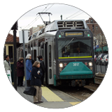
The plan to extend Green Line light rail service to Somerville and Medford is getting back on track after the project stalled last year because of significant cost overruns, a setback that inflated the cost estimate from nearly $2 billion to as much as $3 billion and caused the state to put construction on hold and re-evaluate the project design, procurement, management, and funding.

On August 18, 2016, the MPO amended its Long-Range Transportation Plan (LRTP), Charting Progress to 2040, to make the document consistent with the MPO’s recently adopted Transportation Improvement Program (TIP)—a rolling five-year plan that finances construction of highway, transit, and multimodal projects and programs—and the Massachusetts Department of Transportation’s Capital Investment Plan (CIP)—which documents projects that are prioritized and funded by the state.
