
Staff have created several environmental planning and hazard mitigation resources for planners and stakeholders in the region:
- Destination 2050’s Needs Assessment StoryMap, which contains analyses and recommendations for reducing the vulnerability of the existing transportation infrastructure to natural disasters and other hazards in the region
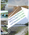 Exploring Resilience in MPO-funded Corridor and Intersection Studies, a study that provides a foundation for including natural hazard risk mitigation themes in the MPO’s transportation studies and contains a case study on environmental vulnerability in Revere, Massachusetts
 All-Hazards Planning Application, which provides an interactive platform for exploring climate and transportation-related data
- Climate Resilience Guidance for Planners, a StoryMap that provides municipal planners with strategies on how to incorporate risk mitigation into their transportation projects
Exposure to Environmental Hazards in the Boston Region
According to the 2022 Massachusetts Climate Change Assessment and the 2018 State Hazard Mitigation and Climate Action Plan, the following are projections for the Commonwealth and the Boston region:
- Changes in sea levels
The relative mean sea level in Boston Harbor is expected to rise between 1.4 and 2.4 feet by 2050, which will increase the number of flooding events from high tides and storm surge.
- Changes in precipitation
Parts of the Boston region may experience up to 12 percent more annual rainfall by 2070, while individual rainfall events will become more variable, severe, and punctuated by periods of drought.
- Changes in extreme heat days
Inland parts of Massachusetts may experience up to 25 days over 90°F annually by 2050, compared to just four days historically. Coastal parts of the state may not experience as drastic a change in extreme heat days, although this might be offset by the urban heat island effect in the more developed parts of the Boston area.
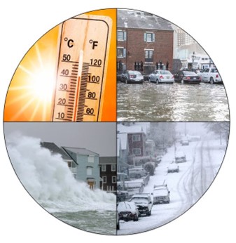
(Image credits: Top left: NBC Los Angeles; Top right: Conservation Law Foundation;
Bottom left: Boston Herald; Bottom right: Boston Globe)
These hazards will impact all aspects of the transportation system, including rider safety, system reliability, and infrastructure condition. A coordinated effort among government agencies and other stakeholders will be needed to guide investments in risk mitigation to reduce vulnerability to hazards.
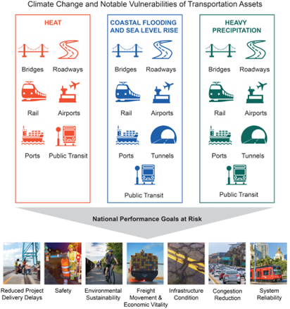
(Image credits: Fourth National Climate Assessment, U.S. Global Change Research Program)
Climate Change and Notable Vulnerabilities of Transportation Assets
Six transportation assets,
- Bridges;
- Roadways;
- Rail;
- Airports;
- Ports; and
- Public Transit
are vulnerable to all three effects of climate change,
- Heat;
- Coastal flooding and sea level rise; and
- Heavy precipitation
while tunnels are additionally vulnerable to the last two effects. These vulnerabilities put the following National Performance Goals at risk:
- Reduced project delivery delays,
- Safety,
- Environmental sustainability,
- Freight movement and economic vitality,
- Infrastructure condition,
- Congestion reduction, and
- System reliability.
Ongoing and Future Work
- Updating criteria for project selection in the TIP related to the capacity for infrastructure to withstand a range of environmental conditions, in collaboration with regional environmental advocacy groups and agencies
- Expanding vulnerability assessment work started for Destination 2050’s Needs Assessment to further our ability to identify risks to the region’s transportation assets, guide outreach and project initiation, and inform funding decisions within the framework of the MPO’s planning process
- Updating the Destination 2050 Needs Assessment, to continue to identify transportation assets in need of protection from a range of hazards
- Leveraging the findings of the Strategies for Environmental Outreach and Engagement (PDF) (HTML) study to improve engagement and communication with regional environmental advocacy groups
Contact Us
Lauren Magee
Environmental Planner
lmagee@ctps.org